OpenStreetMap

Users' Diaries

Recent diary entries

Posted by A35K on 20 May 2024 in English.

First time writing a diary, I have no idea how this is supposed to work

First off I´m gonna talk about the class:bicycle tag

This tag is used to describe how comfortable a certain way is for a cyclist (with class:bicycle=3 being great and …=-3 being really bad). The tag is mostly subjective and surveys are needed.

I first started using it when OSM based routers kept routing me over a secondary road where it is technically legal (?) to cycle on but rather dangerous due to heavy motor traffic combined with a speed limit of 80km/h. Since only GraphHopper seems to be using the class:bicycle tag for it´s routing it´s the only OSM router which has now stopped telling me to use that road. Great success!

Now fast forward a few weeks and I found out that this tag is extensively used in Munich to “improve” bicycle routing. I don´t fully agree with the way the people there implemeted it as now busy roads are tagged as “better” as seperate cycleways due to irrelevant things such as width.

But I don´t live in Munich so it´s not my problem, so I´d rather focus on implementing this tag in the city of Unterschleißheim. I´ve already done some progress and pretty much every road and path in Lohof-Süd is now equipped with this tag to improve routing, and it did work pretty well as Graph Hopper uses the safer roads even if the route will end up being a few meters longer. Great success again!

I want to implement this tag in other areas of Unterschleißheim but I am not really sure how to make sure that I´ve reviewed every road. I thought about creating a spreadsheet with every road name of the city but that would take a lot of time or good overpass-api skills (which I don´t have). I´ve decided that I would split the city into different sectors and add the class:bicycle tag for those sectors one by one.

About mapillary…

While this doesn´t fit to the rest of the diary I still want to include this as it would help implementing the tag.

I´ve decided that I wanted to add mapillary coverage of Unterschleißheim using my phone attached to my bicycle. After finally figuring out how the mobile app works (thanks to some folks in the OSM-World Discord server) I tried attaching my phone to my bicycle using duct tape. Not professional but if it works why not? I spent about one and a half hours trying to duct tape my phone onto the headlight, making sure that nothing was in the way of the camera but I gave up realizing that I would just look like an idiot cycling around with a phone duct-taped to my bicycle headlight. So that means no mapillary imagery for my city until I´ve figured out a way

Location: 48.279, 11.576

Discovering the New Casino in Rio de Janeiro

Olá fellow mappers,

I recently had the opportunity to map an exciting new development in Rio de Janeiro—a brand-new casino complex. This addition is poised to become a significant attraction in the city, and I wanted to share the updates and my experiences with the community.

New Casino Complex Details

The new casino, Casino Rio, is located in the vibrant neighborhood of Barra da Tijuca. Here are the key details I’ve added to the map:

Casino Rio at Avenida Lúcio Costa and Rua João de Barros (Latitude: -23.0035, Longitude: -43.3445) Main Building: A sprawling structure featuring gaming floors, restaurants, and entertainment venues. Hotel Tower: A luxury hotel adjacent to the casino, providing accommodations for visitors. Parking Facility: A multi-story parking structure to accommodate the influx of guests. Enhanced Accessibility and Amenities

With the new casino, several infrastructure enhancements were necessary. I updated the following:

Avenida Lúcio Costa: The main road leading to the casino has been expanded to four lanes to handle increased traffic. Pedestrian Walkways: New pedestrian pathways have been added to ensure safe access from nearby hotels and beaches. Public Transport Links: The casino is now well-connected with updated bus routes and a new shuttle service from key locations in Rio de Janeiro. Challenges and Observations

Mapping this development was a unique challenge. The area is rapidly developing, and much of the satellite imagery was outdated. I had to rely heavily on recent visits, local knowledge, and available GPS traces to ensure accuracy. If anyone has more recent data or can verify details on-site, your input would be invaluable.

Future Plans

I’m thrilled to see how this new casino will influence the local area and attract visitors from around the world. If any mappers in Rio de Janeiro or those familiar with the area have additional insights or would like to collaborate on further updates, please reach out. Our collective efforts will help keep the map as accurate and useful as possible.

Happy mapping!

Tags: #CasinoRio #RioDeJaneiro #urbanmapping #community #newdevelopments

Location: -23.004, -43.345

Exploring the Rapid Changes in Vila Olímpia, São Paulo

Olá fellow mappers,

This past week, I dedicated my time to mapping the ever-changing neighborhood of Vila Olímpia in São Paulo. The area has seen significant development lately, and I wanted to share my updates and experiences with the community.

New Commercial Buildings and Parks

Several new commercial buildings have been completed, transforming the skyline of Vila Olímpia. I updated the map with the following notable additions:

Infinity Tower at Rua Funchal and Avenida Juscelino Kubitschek (Latitude: -23.5955, Longitude: -46.6845) JK Iguatemi Mall near the intersection of Avenida Juscelino Kubitschek and Avenida Chedid Jafet (Latitude: -23.5950, Longitude: -46.6849) Additionally, a new park, Parque do Povo, has been established along Avenida Henrique Chamma (Latitude: -23.5956, Longitude: -46.6872). This park is a great green space featuring walking paths, playgrounds, and exercise areas. It’s now accurately represented on our map!

Enhanced Road Network

With the new developments, there have been changes to the road network as well. I made the following updates:

Rua Gomes de Carvalho now extends to connect with Avenida Brigadeiro Faria Lima (Latitude: -23.5952, Longitude: -46.6851). Rua do Rocio has been widened to accommodate increased traffic near the new commercial hubs (Latitude: -23.5948, Longitude: -46.6856). I’ve also added several pedestrian walkways and bike paths to improve the map’s detail and usability for non-motorized users.

Challenges and Collaboration

Mapping these changes presented a few challenges. The area is developing rapidly, and some of the satellite imagery was not up-to-date. I relied on local knowledge and GPS traces to ensure the accuracy of my updates. If anyone has more recent data or can provide on-the-ground verification, your help would be greatly appreciated!

Future Plans

I’m excited to see how Vila Olímpia continues to evolve and look forward to mapping these changes. If any mappers in São Paulo are interested in collaborating or have suggestions, please feel free to get in touch. Together, we can ensure our map remains a reliable resource for everyone.

Happy mapping!

Tags: #VilaOlimpia #SãoPaulo #urbanmapping #community #newdevelopments

Location: -23.595, -46.685

سایت حضرات با بونوس ویژه:hazaratiha.com حضرات یکی از سایت‌های شرط‌بندی و کازینو آنلاین ایرانی است که در سال 1396 فعالیت خود را آغاز کرده است. این سایت دارای مجوز از Curacao eGaming است و از نظر امنیتی مورد تایید قرار گرفته است. حضرات بت طیف گسترده‌ای از بازی‌های کازینو و شرط‌بندی ورزشی را به کاربران خود ارائه می‌دهد.

برخی از ویژگی‌های کازینو آنلاین حضرات عبارتند از:

واریزی و برداشت امن و آسان:حضرات بت از روش‌های مختلفی برای واریزی و برداشت وجه پشتیبانی می‌کند، از جمله کارت‌های بانکی، پرفکت مانی، بیت‌کوین و اتریوم. پشتیبانی از زبان فارسی: تمام بخش‌های سایت حضرات بت به زبان فارسی ترجمه شده‌اند و پشتیبانی 24 ساعته فارسی نیز در دسترس کاربران است. بونوس‌ها و جوایز متعدد: حضرات بت بونوس‌ها و جوایز متعددی را به کاربران خود ارائه می‌دهد، از جمله بونوس خوش‌آمدگویی، بونوس‌های رفرال، بونوس‌های بازی‌های خاص و جوایز نقدی و غیر نقدی. تنوع بازی‌ها:** حضرات بت طیف گسترده‌ای از بازی‌های کازینو و شرط‌بندی ورزشی را به کاربران خود ارائه می‌دهد، از جمله:بازی‌های کازینو اسلات، رولت، بلک جک، باکارات، پوکر و … شرط‌بندی ورزشی:فوتبال، بسکتبال، تنیس، والیبال، کریکت و … اپلیکیشن موبایل حضرات بت اپلیکیشن موبایل برای سیستم عامل‌های اندروید و iOS دارد که به کاربران امکان می‌دهد به راحتی از طریق گوشی یا تبلت خود به حساب کاربری خود و بازی‌ها دسترسی داشته باشند.

حضرات بت یکی از محبوب‌ترین سایت‌های شرط‌بندی و کازینو آنلاین ایرانی است و به دلیل تنوع بازی‌ها، بونوس‌ها و جوایز متعدد و پشتیبانی از زبان فارسی مورد استقبال کاربران قرار گرفته است. ش

اگر به دنبال آدرس محل ساخت سوله و سازه فلزی میگردید اگر بدنبال عقد قرارداد با کارخانه ساخت سوله هستید آدرس کارخانه سوله سازی در اردبیل اینجاست شرکت تولید کننده سوله و سازه فلزی در ایران ،اردبیل

The Bangladesh Open Innovation Lab (BOIL) and OpenStreetMap Bangladesh (OSMBD) are teaming up to host the “State of the Map Bangladesh (SotMBD) ‘2024” conference, a first of its kind in Bangladesh, a national gathering focused on mapping and geospatial technology. It aims to gather all significant stakeholders, including IM professionals, NGOs, government counterparts, industry leaders, academic experts, and geospatial enthusiasts from across the nation and the globe. This inaugural event aligns with the broader “State of the Map (SoTM)” event series facilitated by the OpenStreetMap Foundation and the global OpenStreetMap Community, reflecting a global effort to enhance open mapping initiatives. Additionally, SotMBD will be integrated into the Humanitarian OpenStreetMap Team’s (HOT) Opensummit program, emphasizing its role in fostering collaboration and sharing knowledge in the geospatial community.

Set against the breathtaking backdrop of Cox’s Bazar, the longest natural sandy sea beach in the world, the extraordinary event is set to unfold that promises to captivate and inspire. Scheduled for September 28th and 29th, 2024, this unique gathering aims to unite a diverse array of participants for a celebration of community and cooperation. The tranquil and scenic beach view will be an ideal location for an event aimed at promoting connections and creating enduring memories. Cox’s Bazar, known for its breathtaking views and lively local culture, not only serves as a location but also provides an engaging experience that enhances the atmosphere and appeal of the event. The organizers are carefully curating a program that will not only leverage the scenic beauty of the area but also underscore a commitment to inclusivity and engagement. Whether you are a local resident or a visitor from afar, this event promises an enriching experience that showcases the best of what Cox’s Bazar and Bangladesh have to offer.

Participants can expect a diverse range of activities, including workshops, keynote speeches, and panel discussions aimed at fostering a deeper understanding of open-source mapping tools and their applications in addressing real-world problems. The conference will also emphasize local developments in geospatial technology and how these can be integrated with global networks to improve the quality and accessibility of map data in a regional and global context. Whether you’re a professional geographer, an information management professional, a developer, an academic, or simply someone passionate about digital collaboration, frontier technologies, and community development, SotMBD offers a unique opportunity to network, learn, and contribute to shaping the future of the geospatial industry in Bangladesh. Prepare to be inspired by keynote speeches from leading figures in the geospatial field, and don’t miss the chance to contribute your own insights in interactive sessions and panel discussions. With a focus on the practical, innovative, and transformative uses of data-driven evidential frameworks, geospatial & non-geospatial data-backed solutions, open mapping ecosystems, and, of course, OpenStreetMap in addressing local challenges, this event is not just a conference—it will be a community builder, a place for growth, and a forum for change.

Overall, SotMBD will act as a catalyst for innovation and collaboration, crucial for realizing the Smart Bangladesh 2041 vision by leveraging technology to address national challenges and enhance the quality of life for its citizens, while at the same time promising to be a trendsetter in the regional & global context.

Stay Tuned for more updates…

Location: 21.416, 91.984

We participated in the OSPP hosted by the Chinese Academy of Sciences, which stands for Open Source Promotion Plan. It is held during the summer every year and encourages students of all grades to contribute to open source projects from July to September. This is very similar to GSoC.

Introduction

OpenStreetMap is a map project initiated in 2004 by Steve Coast of the UK, based on the principle of knowledge openness. Its data model enables mappers to represent and abstract complex real-world structures by utilizing three abstract elements types, for instance, public transportation. Since 2016, the OSM Community has submitted projects related to public transport to GSOC annually. The main work is focused on a JOSM plugin called PT Assistant.

Currently, the project we initiated aims to develop a cross-platform editor utilizing a modern front-end technology stack, which is easy to use with clear interactions.

Why do we need this project?

When editing public transportation relations using iD or JOSM, you may often spend a lot of time on tasks such as selecting each segment from the starting point to the endpoint. You might be surprised to find that even at an intersection where you want to turn, the continuous straight line has not been broken for your selection.

We hope to reduce such energy consumption thing for mapper when editing public transportation by automatically calculating possible bus routes through short-distance navigation after mappers specify the stations along the way. The mapper can then fine-tune it so that it conforms to the actual route taken by buses.

At the same time, we also hope to save time in certain situations, such as when creating a group of bus stops with identical names. There is no need for manual maintenance of multiple bus stop signs composed of relations; they will be automatically matched for you. Or when moving a station sign, parking spots are moved automatically.

Overall, our goal is to reduce friction and make it easier and faster for people to create new bus lines.

Project Deliverable Requirements

  • Ability to add stations and create or delete route relationships (with variable member order) within the editor and upload them via OSM API 0.6.
  • Ability to automatically calculate viable routes based on the road network and control points in the map, and automatically split longer paths for easier relationship addition, when only station data is available.
  • Implementation of at least a prototype containing the main functionalities.

Project Technical Requirements

  • Ability to use front-end technology stack to develop complex interface cross-platform programs, with knowledge of WebGL. (Experience with WebGL GIS frameworks such as Cesium.js/MapboxGL is a plus) (Note: Depending on the final choice of technology stack, knowledge of graphics and WASM might be required. She has always admired Meta for being able to create RapiD.)
  • Adequate algorithmic skills, with some understanding of navigation algorithm implementation. (Experience with open-source navigation routing tools like OSRM, Graphhopper, Valhalla, etc., is a plus.) (Note: Actually not such important.)
  • Understanding of the OpenStreetMap data model and API. (Knowledge of community culture and collaboration methods, or previous use of related data for analysis or other purposes, is very important.) (Note: Actually not such important. Since it is a notice posted in the OSM website, we can assume that applicants who see this requirement are already very familiar with it.)

Some important notes

  1. The project language is Chinese and some materials that need to be submitted later are also in Chinese. However, if there are any unclear points about the application, community members can provide language assistance and you can still communicate with your mentor in English.
  2. Although as the mentor, a very ashamed thing is that laoshubaby isn’t very proficient in front-end; this arrangement was originally aimed at students who have no knowledge about OSM whatsoever. Therefore she was chosen as a mentor due to being an active community member.
  3. For non-Chinese students receiving bonuses may take longer - possibly until January or February 2025 - rather than being paid upon completion of their projects. This bonus does not come from OSMChina or TUNA but from OSPP’s sponsor CAS (Chinese Academy of Sciences).
  4. The deadline for student applications is June 3, 2024 at 7:00 AM UTC. The complete guide for students participating in the project can be found at https://summer-ospp.ac.cn/help/en/student/#5-student-bonus (If your browser’s locale cannot be detected, you can click on the “中文/EN” button in the upper right corner of the webpage to switch languages.)

Registed information on OSPP


OSMChina (with the help of Tsinghua University TUNA Association and special thanks for their valuable assistance and support.)

Hello OSM World,

This is the first post in the Worst of OSM in Ghana series. I start with improving landuse=residential in Kumasi.

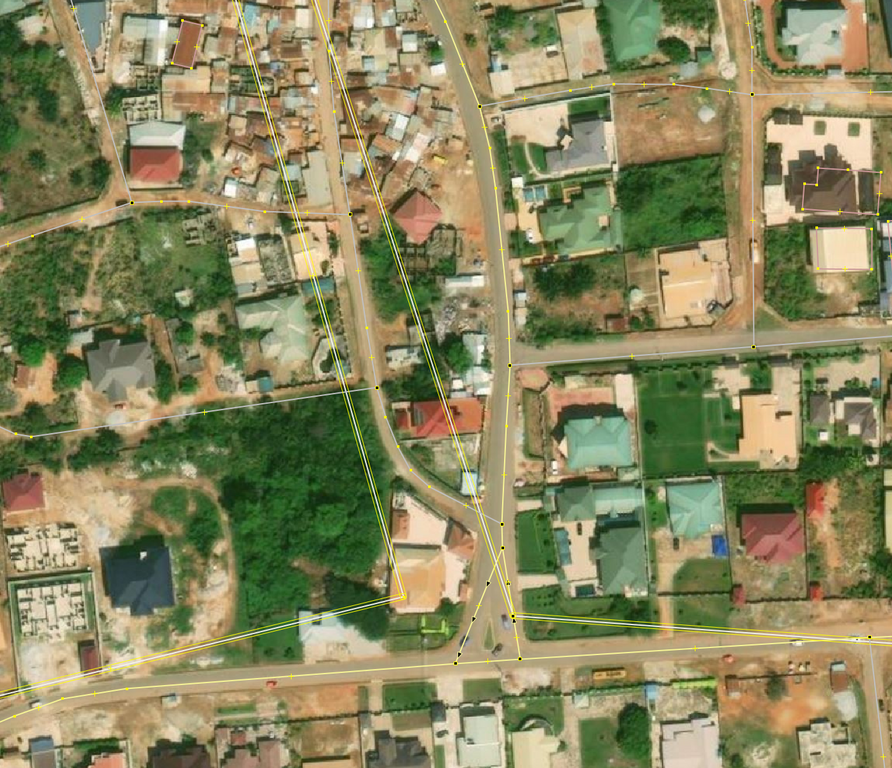
About 3 years ago someone mapping for an institution decided to randomly map a ton of residential landuse areas across Ghana. Some local contributors had lengthy message exchanges with them before they stopped to map. Why? Because these landuse areas are either connected to some building or highway, etc… © OpenStreetMap Contributors. Screenshot from JOSM with Bing

Fast forward 2024, many of these ways still exist in OSM and interferes with new contributions. Kumasi was selected as the start of trying to reuse/delete/improve these landuse=residential because Sammyhawkrad have really put a lot of time into improving data coverage in Kumasi but these landuse=residential definitely throws him away.

In summary this is how I improved the data:

  1. First, I reached to active editors in this area about my planned mass modifications
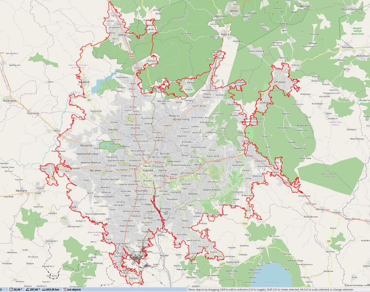
  2. Using JOSM, I drew a large area around Kumasi in a local layer © OpenStreetMap Contributors. Screenshot from JOSM with OSM Carto
  3. Started splitting with More tools → Split Object [ALT+X ]
  4. I then downloaded data from OSM separately and merged into local layer
  5. I tried to reuse existing ways as possible using More tools → Replace Geometry [CTRL+SHIFT+G] (requires UtilsPlugin2) which sometimes resulted in issues and conflicts when I update data [CTRL+U]. Because a node was shared with a building or highway.
  6. It took more hours than expected to complete this. At some points I could only delete than re-use.
  7. Finally, I uploaded the data when it’s assumed less mappers will be contributing in this area (somehow helps me to avoid some unexpected conflicts)

Notes

Massive remote mapping of features is much helpful when they don’t take all of local mappers time undoing your contributions, it is also demotivating.

There are many of these occurrences across the Ghana and likely somewhere else that needs clean up and more hands, I hope this summary inspires and is helpful for other local mappers to improve and contribute quality data.

If you are mapping in Ghana, Beware of imagery offsets and rapidly growing settlements not to add useless data.

Happy mapping!

Location: 6.700, -1.612

sorry if my grammar sucks and all that I never had a good grasp on it in life. It’s been a few days since I started modeling Sweetwater so it can show up on Pokémon go when it updates their map though I’ve been aware that they might use specific versions but never hurts to model the town still, but the only issue is that no one in my town uses OSM anymore meaning I am completely alone.. a few days ago, I tried getting help which did work but not in the way I expected but hey better than nothing well all I wanted was help with buildings and all of that due to the town of Sweetwater Texas being hardly mapped (buildings wise). I tried requesting help though the notes, but it got resolved but the person gave me a website to help making it a bit faster but also giving me somewhat outdated building data.

if you’re interested in this whole thing and want to help out with the buildings or just update some information here’s the link to Sweetwater Texas

Recently while updating business information in my area, I noticed that outdated POIs would often include a defunct website. When attempting to follow the links in OSM, I was just presented with an error. That gave me the idea that I could proactively identify POIs that may need validated in person.

After some tinkering, I came up with a python script that will query OSM data for nodes with websites, then iterate over the websites to see which return errors when connecting. I started with logging these to a text file, but then realized that I could export them all to a kmz file and import them into Organic Maps. Now when I’m out and about I can launch Organic Maps to find areas that I should validate.

Screenshot of Organic Maps with pins through Amsterdam

When you select a pin, it’ll give you more details on the failure.

Screenshot of Organic Maps with one pin selected. It display the website, http error, and OSM link

While testing I noticed that there are also many sites getting errors indicating that the specific page isn’t found or that the page can be found at a new location. I believe that these can be validated without surveying, so I set up a separate mode called “armchair” mode that highlight these errors.

Setup

NOTE: This will initiate connections from your machine to whatever websites exist in OSM

To use the script, copy the below file and save it as “broken-websites.py”. Before running I believe you’ll need to install the required packages by running the below commands in your terminal:

pip3 install simplekml
pip3 install overpy
pip3 install geopy

From there you can change that latitude, longitude, and radius. Keep in mind that a larger radius takes exponentially longer. You can commands like:

# List all websites that return a 5XX error to a text file
python3 ./broken-websites.py survey txt

# Generate a kmz of all websites that redirect or return 404
python3 ./broken-websites.py airchair kmz

# Generate both list types to both file types
python3 ./broken-websites.py both both

Script:

import overpy
from geopy.distance import geodesic
import requests
import datetime
import simplekml
import sys

latitude = 52.377956
longitude = 4.897070
radius = .5  # Default radius in kilometers

def check_website(url):
    try:
        response = requests.head(url, timeout=10)
        return response.status_code, response.reason
    except Exception as e:
        return None, str(e)

def get_amenities():
    api = overpy.Overpass()

    # Define bounding box
    lat_min = latitude - (radius * 0.009)
    lat_max = latitude + (radius * 0.009)
    lon_min = longitude - (radius * 0.009)
    lon_max = longitude + (radius * 0.009)

    query_str = f"""
        node["website"]
            ({lat_min},{lon_min},{lat_max},{lon_max});
        out;
    """

    result = api.query(query_str)

    amenities = []

    for node in result.nodes:
        name = node.tags.get("name", "Unknown")
        amenity_type = node.tags.get("amenity", "Unknown")
        lat = float(node.lat)
        lon = float(node.lon)
        website = node.tags.get("website", "N/A")
        distance = geodesic((latitude, longitude), (lat, lon)).kilometers
        osm_link = f"https://www.openstreetmap.org/node/{node.id}"
        if distance <= radius:
            amenities.append({"name": name, "amenity_type": amenity_type, "latitude": lat, "longitude": lon, "website": website, "distance": distance, "osm_link": osm_link})

    return amenities

def save_to_kmz(amenities_with_broken_websites, mode, timestamp):
    kml = simplekml.Kml()
    icon_url = 'https://upload.wikimedia.org/wikipedia/commons/e/ec/Red_dot.svg'  # Privacy-friendly icon URL
    for amenity in amenities_with_broken_websites:
        description = (f"<p>Website: <a href='{amenity['website']}' target='_blank'>{amenity['website']}</a></p>"
                       f"<p>{amenity['error_message']}</p>"
                       f"<p><a href='{amenity['osm_link']}' target='_blank'>Link to OSM</a></p>")
        placemark = kml.newpoint(name=amenity['name'],
                                  description=description,
                                  coords=[(amenity['longitude'], amenity['latitude'])])
        placemark.style.iconstyle.icon.href = icon_url
    file_name = (f"Broken_Websites_{mode}_Radius_{radius}km_Lat_{latitude}_Long_{longitude}_{timestamp}.kmz")
    kml.savekmz(file_name)
    print(f"KMZ file saved as: {file_name}")


def save_to_txt(amenities_with_broken_websites, mode, timestamp):
    file_name = (f"Broken_Websites_{mode}_Radius_{radius}km_Lat_{latitude}_Long_{longitude}_{timestamp}.txt")
    with open(file_name, 'w') as f:
        for amenity in amenities_with_broken_websites:
            f.write(f"Name: {amenity['name']}\n")
            f.write(f"Amenity Type: {amenity['amenity_type']}\n")
            f.write(f"Latitude: {amenity['latitude']}\n")
            f.write(f"Longitude: {amenity['longitude']}\n")
            f.write(f"Website: {amenity['website']}\n")
            f.write(f"Distance: {amenity['distance']:.2f} km\n")
            f.write(f"Error: {amenity['error_message']}\n")
            f.write(f"OpenStreetMap: {amenity['osm_link']}\n")
            f.write("\n")
    print(f"Text file saved as: {file_name}")

def filter_amenities(amenities):
    filtered_amenities = {"survey": [], "armchair": []}
    for amenity in amenities:
        status_code, error_message = check_website(amenity['website'])
        if not status_code or 500 <= status_code < 600:
            amenity['error_message'] = f"Status Code: {status_code}, Error: {error_message}"
            filtered_amenities["survey"].append(amenity)
        if status_code and (300 <= status_code < 400 or status_code == 404):
            amenity['error_message'] = f"Status Code: {status_code}, Error: {error_message}"
            filtered_amenities["armchair"].append(amenity)
    return filtered_amenities

def main():
    if len(sys.argv) != 3:
        print("Usage: python script.py <mode> <output>")
        print("Mode should be one of: survey, armchair, both")
        print("Output should be one of: txt, kmz, both")
        return

    mode = sys.argv[1]
    output = sys.argv[2]
    if mode not in ["survey", "armchair", "both"]:
        print("Invalid mode. Mode should be one of: survey, armchair, both")
        return

    if output not in ["txt", "kmz", "both"]:
        print("Invalid output. Output should be one of: txt, kmz, both")
        return

    print(f"Searching for amenities with websites within {radius} km...")

    amenities = get_amenities()

    if amenities:
        print("\nChecking websites...")
        filtered_amenities = filter_amenities(amenities)

        timestamp = datetime.datetime.now().strftime('%Y-%m-%d_%H-%M-%S')

        if mode in ["survey", "both"]:
            if filtered_amenities["survey"]:
                # print(f"Found {len(filtered_amenities["survey"])} broken websites")
                if output in ["kmz", "both"]:
                    save_to_kmz(filtered_amenities["survey"], "survey", timestamp)
                if output in ["txt", "both"]:
                    save_to_txt(filtered_amenities["survey"], "survey", timestamp)
            else:
                print("No amenities found with broken websites in survey mode.")

        if mode in ["armchair", "both"]:
            if filtered_amenities["armchair"]:
                # print(f"Found {len(filtered_amenities["armchair"])} broken websites")
                if output in ["kmz", "both"]:
                    save_to_kmz(filtered_amenities["armchair"], "armchair", timestamp)
                if output in ["txt", "both"]:
                    save_to_txt(filtered_amenities["armchair"], "armchair", timestamp)
            else:
                print("No amenities found with broken websites in armchair mode.")
    else:
        print("No amenities found within the specified radius or with specified website.")

if __name__ == "__main__":
    main()

Compléter l’étymologie des rues d’une commune

Sujet culturel et rigolo que de retrouver facilement ce que représente le nom d’une rue. Le tag name:etymology:wikidata permet de relier un objet OSM à Wikidata où l’on retrouve les données liées du Web de l’humanité :-).

Process:

  • Extraction des rues de la commune avec Overpass
  • De nombreuses moments pour faire la correspondance entre le nom de la rue et son objet Wikidata (recherche sur le web, dans des livres, aux archives communales et départementales) ;
  • Gestion du tout avec OpenRefine. Merci Wikitech pour la mise à disposition <3
  • Mise à jour du tag name:etymology:wikidata depuis le fichier constitué à l’aide du code Yapafo. Le commentaire du changeset est explicite et accompagné du hashtag “#TagNameEtymologyWikidata

Les données étymologies sont visualisables avec le super outil Open Etymology Map de Daniele Santini.

Mise à jour du taux de complétion des adresses dans OpenStreetMap. Cet article fait suite à 2 autres ici en mai 2023 et là en septembre 2022, où je compare le nombre d’adresses par communes en Wallonie entre la source de référence des adresses (ICAR) et OSM.

En Wallonie, 1,196,551 adresses sont répertoriés dans OSM, contre 1,634,840 dans ICAR (73.2 %). On était à 64.4 % en septembre 2022 et 67.1% en mai 2023.

Voici une carte choroplète, montrant, pour chaque commune, le degré de complétion des adresses dans OSM par rapport à ICAR. Les limites de provinces sont soulignées par un trait plus gras.

carte complétion adresses mai 24

Et une carte de l’évolution des adresses depuis mai 2023.

carte évolution adresses mai 23 - mai 24

Les 10 communes où les adresses ont le plus progressé sont:

  1. Manage (+98% !)
  2. La Louvière
  3. Le Roeulx
  4. Dour
  5. Grez-Doiceau
  6. Braine-le-Comte
  7. Chastre
  8. Celles
  9. Incourt
  10. Perwez

Et les communes où les adresses sont le moins complètes sont:

  1. Ecaussines
  2. Dour
  3. Quévy
  4. Soignies
  5. Braine-le-Comte
  6. Mons
  7. Flobecq
  8. Pont-à-Celles
  9. Rebecq
  10. Ittre

À noter que dans beaucoup de communes, toutes les adresses sont complètes (par ex. Saint-Ode, fait récemment), mais que le rapport est toujours en-dessous de 100%, parce qu’ICAR affiche des numéros d’adresses pour des parcelles loties, mais non encore construites.

RDV sur cette page de discussion, sur la page du wiki import des batiments et adresses et sur cette carte pour continuer à compléter les adresses.

Location: Au Pigeon, Marbehan, Rulles, Habay, Virton, Luxembourg, Wallonie, 6724, Belgique

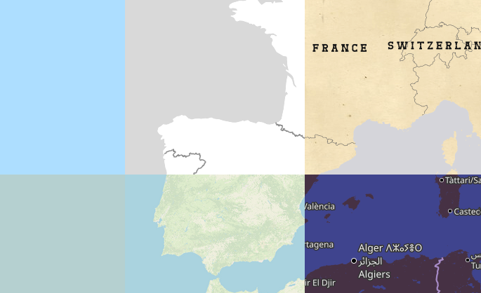
Example of different map styles

Let’s imagine that you’re a pizza delivery company, and you’ve got an app that shows where you are, where your customers are and where a delivery person is between the two. Obviously you need some sort of map that shows the three in context. You can’t use Google Maps for cost or other reasons, and whatever framework your using will accept raster tiles in the almost universal format https://server/Z/X/Y.png, so why not use OpenStreetMap’s standard layer? After all, it’s free!

Well:

  • It’s not free, in the sense of free laid out in the tile usage policy. That doesn’t mean that OSM doesn’t tolerate or even encourage some use of those tiles, but it does mean that you have no service level agreement - you probably won’t even get warned if your use is prevented at some point in the future.

  • It’s not a great background map. The “OSM Carto” style tries to do two things at once - it tries to provide feedback to OSM mappers and it tries to be a “nice” standalone map. Both of those make its use as a background less than ideal. To see some alternative map styles (some of which are designed as background maps) have a look at openwhatevermap.xyz.

  • It’s updated on the fly. While OpenStreetMap gets surprisingly little vandalism considering the scale and visibility of the project, it does get some; and any map that is instantly updated will show what there is until the vandalism is fixed both in both the map data and the server-side infrastructure. Your pizza delivery company probably only needs to process updates to a map layer for a small area and when new roads and new housing estates are built; perhaps once every few months or so.

So what can you do?

It’s important to remember that OpenStreetMap’s Data is still free. You’re welcome to use that, and plenty of companies are willing to help.

If you can’t afford that, and can only spare about the price of an average-sized pizza a month, you can do it yourself. Deploying a map as described on this page could cost under €10 per month. If you want to run occasional updates, that’s documented too - just run it whenever it’s convenient for you.

– Andy

(a member of the DWG, and also a maintainer of the “switch2osm” site, but writing this in an entirely personal capacity)

The screenshot at the top is from openwhatevermap - click through from there to see the details of each style and terms of use.

Location: 10.473, 13.097

Amazing Experience ……..

The open street map foundation is an international not - for - profit organization supporting, but not controlling. the OSM project. it is dedicated to encouraging the growth, development and distribution of free geospatial data and to proving geospatial data for anyone to use and share. The OSMF had quite recently Started a worldwide membership campaign with the objective of growing and diversifying OSMF membership in regions where there are very low or no OSMF members.

I am proud to say that I was part of this campaign. On the first few virtual meetups via Google meet, I had promptly signed up for the campaign Ambassadors role as I believed I could use whatever little ideas and experiences. I have learnt a lot about community.

thank you for the wonderful opportunity.

Providing updates! The OSM Wiki of the OSMF Membership Drive Campaign 2024 Plan is in the wiki: https://wiki.openstreetmap.org/wiki/OSMF_Membership_Drive_2024

We will also provide updates and have a space for feedback in the Community Forum using this thread: https://community.openstreetmap.org/t/updates-osmf-membership-drive-campaign-2024/109280

Welcome to the seventh OpenStreetMap NextGen development diary.

This week, I focused on delivering core website functionalities and website and migration script optimizations 🚤.

🔖 You can read my other development diaries here:
https://www.openstreetmap.org/user/NorthCrab/diary/

📖 This project is open-source and publicly available:
https://github.com/Zaczero/openstreetmap-ng

🛈 This initiative is not affiliated with the OpenStreetMap Foundation.

In Case You Missed It…

OpenStreetMap-NG is planned to have its first development release at the end of this month, May. After this milestone, the project will be open for new contributors! My current work focuses on delivering on that promise, finishing the core functionalities, and stabilizing the code.

Originally posted in diary #5.5.

New Fast Rendering Engine

One of the highlights of OpenStreetMap-NG is its brand new, super fast object rendering engine. It’s a significant improvement over the current solution.

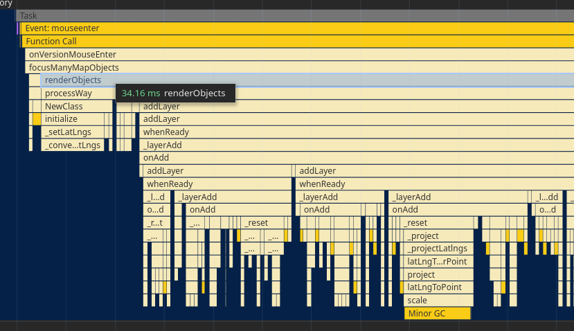
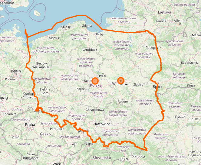
For example, rendering all of Poland (about 1500 ways) takes a mere 34ms.

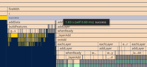
To put that in perspective, the same relation on the current OpenStreetMap website takes about 1.8 seconds. That’s over 50 times faster! And the best part: zero compromises on quality - it’s the same data, just way faster - badum tss.

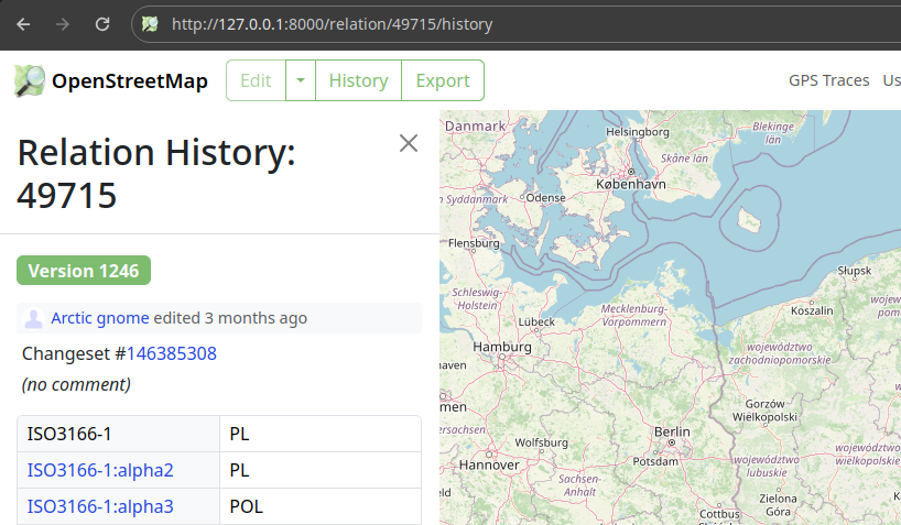
Here’s the visualization we’re talking about:

Support For Historical States

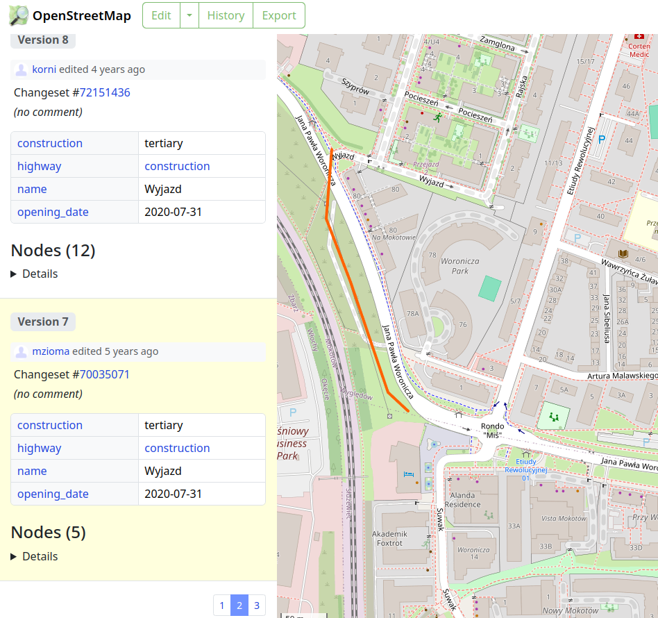
The new rendering pipeline also lets you see how things used to look. Want to check out a street from 5 years ago? Just hover over the version in the history view. Easy.

This feature is going to make it way easier to understand how things have changed over time. It also opens up new opportunities for rich changeset diffs visualizations in the future!

Relations Members Icons

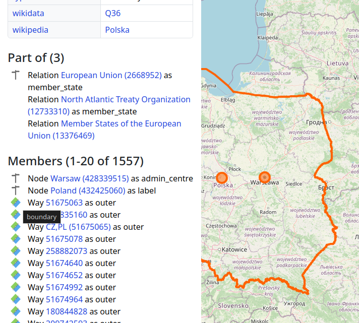
OpenStreetMap-NG now has a bunch of icons for relation members. This makes it much easier to tell what kind of relation you’re dealing with.

These icons are from the iD project.

Page Timeout Fixes

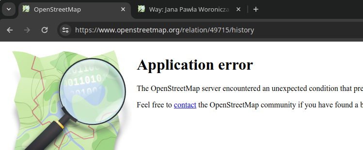
If you’re a frequent OpenStreetMap user, you might have run into errors like this:

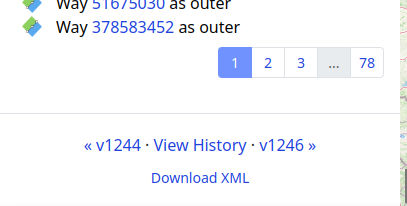
OSM-NG has fixed a ton of these timeout issues with improved pagination. Now everything loads smoothly, even the history of a big relation like Poland.

Refreshed Element Sidebar UI

The element sidebar has received a makeover. The new look and feel are designed for regular users, not just developers. You’ll also find it much easier to use the element versioning system.

Project Sponsors 🏅

Time for the weekly appreciation of the current project patrons. Thank you, everyone, for supporting the project, including those who starred it on GitHub! There’s no way back now 🚂.

Currently, the project is sponsored by 13 people!
Four private and four public donors on Liberapay, and five public on GitHub Sponsors.

If you can, please consider supporting the OpenStreetMap-NG development 🦀:

Donate using Liberapay

本文是中华人民共和国相关部门的法规政策,仅供读者参考。

来源:https://gi.mnr.gov.cn/202405/t20240511_2844891.html https://www.gov.cn/zhengce/zhengceku/202405/content_6950568.htm

自然资源部办公厅 工业和信息化部办公厅

关于规范移动互联网应用程序中登载使用地图行为的通知

自然资办函〔2024〕972号

各省、自治区、直辖市自然资源主管部门、电信主管部门,移动互联网应用程序主办者:

近年来,地图以其立体直观、耦合作用显著等特点,不断应用到移动互联网应用程序(以下简称APP)中,在推动经济社会高质量发展、服务百姓生活等方面作用日益凸显。为规范APP登载使用地图行为,进一步提升APP的直观性、交互性、动态性,现将有关事项通知如下:

一、提高政治站位

正确的国家版图是国家主权和领土完整的象征,体现了国家在主权方面的意志和在国际社会中的政治、外交立场。地图是国家版图最常见、最直观的表现形式,具有严肃的政治性、严密的科学性、严格的法定性。APP中登载使用未依法履行地图审核程序的“问题地图”,错绘我国国界线、漏绘我国重要岛屿,甚至标注涉军涉密敏感信息,将严重损害我国国家主权、安全和发展利益。各地、各有关单位、各移动互联网应用程序主办者要坚持总体国家安全观,充分认识正确登载使用地图的重要性,增强国家版图意识,坚决防止“问题地图”的产生。

二、规范相关行为

(一)依法履行行政审批。从事互联网地图服务的APP主办者应按照《中华人民共和国测绘法》《中华人民共和国反电信网络诈骗法》《互联网信息服务管理办法》《地图管理条例》等规定,向自然资源主管部门、电信主管部门履行地图审核程序、ICP备案手续。地图内容发生变化或者进行更新的,应依法重新履行地图审核程序。

(二)严格落实主体责任。APP主办者应落实安全主体责任,确保在登载使用地图时准确反映中国领土范围、行政区域界线、重要岛屿等并标示审图号;引用地图时要注明地图来源和审图号;对违反法律法规登载使用地图的注册用户要依法依约采取警示、限制功能、关闭账号、保存记录并上报等处置措施。从事互联网地图服务的APP主办者,还应持续强化技术能力建设,加强对互联网地图新增内容的核查校对。

(三)强化国家版图意识宣传。APP主办者应按照自然资源主管部门、电信主管部门要求,积极参与国家版图意识宣传工作,知悉了解地图管理相关法律法规,牢固树立“地图无小事”的观念,在APP开发、上线审查阶段明确规范使用地图的要求,从源头上防止“问题地图”的出现,以实际行动维护国家主权、安全。

三、增强协同联动

(一)优化服务。各地自然资源主管部门、电信主管部门要优化地图审核、APP备案政务服务,提供信息化服务等便利措施,提高工作效率。各地自然资源主管部门要加大标准地图投放力度,继续通过标准地图服务系统bzdt.ch.mnr.gov.cn以及国家地理信息公共服务平台“天地图”bzdt.ch.mnr.gov.cn向社会公众免费提供标准地图和具有审图号的地图,不断满足社会公众、法人主体对地图的需求。

(二)建立机制。各地自然资源主管部门、电信主管部门应建立信息共享、应急处理、联合惩戒等工作机制,形成工作合力。两部门定期通报有关地图审核信息及APP备案信息,对梳理发现的APP中的“问题地图”线索进行会商,对重点违规线索开展深入调查,对可能出现的问题进行预判,对趋势性问题提出措施,提高防范“问题地图”和抵御风险的能力,督促APP主办者落实安全管理责任义务。

(三)加强监管。针对登载使用地图的APP存在“应当送审而未送审的,使用未经依法审核批准的地图提供服务的,或者未对互联网地图新增内容进行核查校对的,通过互联网上传标注了含有按照国家有关规定在地图上不得表示的内容的,未在地图的适当位置显著标注审图号的”等违法违规行为,自然资源主管部门将会同电信主管部门对APP主办者依法采取处置措施,营造规范健康的互联网地图服务市场环境。

自然资源部办公厅 工业和信息化部办公厅

2024年4月24日

In March 2023, I conducted a survey on women’s participation in OSM activities. It became apparent that individuals’ perspectives came into place and interpreted the survey topic differently. The survey aimed to gather perceptions, opinions, and insights into why some women do not participate in OSM activities and what factors may discourage those who were already participating from continuing. There were various reactions about the survey, from questioning the relevance of the topic to commending the effort to address it.

I was fortunate to have had support from various individuals for the topic, including Heather Leson, Arnalie Vicario, Pete Masters, Geoffrey Kateregga, and the Geochicas family, who were interested and open to exploring the topic through webinars and discussions. One such webinar featured speakers from diverse backgrounds:

  • Stellamaris Wavamunno Nakacwa, Programme Director at Youthmappers EverywhereSheMaps
  • Mikko Tamura, Community Manager at Open Mapping Hub Asia Pacific
  • Jaqueline Amorim, Expert Mapper in Geostatical Data/HOT Data Quality Intern in 2022

The webinar was moderated by Dr. Prince Kwame Odame from Africa, a lecturer at the University of Education Winneba-Ghana. You can review the webinar here.

A unique aspect of the survey was that, in addition to focusing on individuals who identify as women, I also sought perspectives from men. I was pleasantly surprised by some of their positive viewpoints, although there were also negative responses. I am grateful to everyone who took the time to participate in the survey.

One key takeaway from the survey is the importance of considering diverse perspectives. Just because something may not be perceived as an issue by one person does not mean it isn’t significant to others. We all view the world through different lenses, and it’s essential to be considerate and open-minded to learn from various angles.

I appreciate your patience, and below is the summary of the survey and the full report can be read here.

Thank you all for your understanding and support.

Survey Inforgraph

Survey Inforgraph

Survey Inforgraph

Survey Inforgraph

Survey Inforgraph

Posted by FFWHol_Satoshi on 14 May 2024 in German (Deutsch). Last updated on 20 May 2024.

Zusammenfassung

Hydrantenplanerstellung Freiwillige Feuerwehr Holenbrunn. Ziel war eine lauffähige kostenfreie Lösung um;

  • einen “eigenen” Hydrantenplan zu erstellen (Papier/ für Hydrantenschau).
  • beim Einsatz auch ortsfremden Wehren, das Finden des “besten” Hydranten zu ermöglichen.
  • anderen Wehren die Möglichkeiten aufzuzeigen und die Vorgehensweise weiterzugeben (diese Doku).

Eine weit umfassendere Info findet sich bei https://feuerwehr-grossmehring.de/cms/images/stories/Dokumente/openfiremap_anleitung.pdf

Ziel

  • Aufnehmen der Hydranten
  • Erstellen von Lageplan für Hydrantenschau
  • Ausreichende Genauigkeit für den Einsatz
  • Hydranten per Handy-App im Einsatz auffindbar machen
  • Keine Kosten (Verwendung von Open Source)
  • Niederschwelliger Zugang für viele Teilnehmer
  • Niederschwellige Wartbarkeit durch viele Teilnehmer
  • Kein(e) Wartungsaufwand / -kosten

Out of Scope

  • Leitungspläne
  • Koordinaten-genaue Eintragung (nicht möglich da Messungenauigkeit / Kartenmaterial)
  • RefernezID Stadt eintragen
  • 100% Erfassung (kann sein das Hydranten übersehen wurden)
  • Verifikation der gefunden Hydranten (z.B. stillgelegte Oberflurhydranten könnne nicht identifiziert werden)

Ergebnis:

Noch nicht durch lokale Wehr verifiziert, kann unvollständig sein, solle aber mindestens ~80% (soweit ich das beurteilen kann) der vorhandenen Hydranten, Löchwassertanks und -stellen enthalten:

  • Hydrantenkarte Wunsiedel (unvollständig) https://print.get-map.org/maps/336040
  • Hydrantenkarten (unvollständig): Bernstein, Biebersbach, Breitenbrunn, Göpfersgrün, Hauenreuth, Johanneszeche, Neudes, Rauschensteig, Rügersgrün, Schönlind, Thiersheim(Autohof), Wintersberg, Wintersreuth, Ober-/Unterwoltersgrün, Sinatengrün

Weniger Hydranten, Löchwassertanks und -stellen:

  • Hydrantenkarte (noch unvollständiger): Braunersgrün, Höchstadt i.F., Holzmühl